
Publikacje naukowe
Czyńska K., Rubinowicz P.: Application of 3D virtual city models in urban analyses of tall buildings – today practice and future challenges, „Archtecurae et Artibus” 2014, nr 1(19), pages 9-13, Białystok.
Abstract
The complex geometry of the city structure and the increasing speed of ongoing urban transformations in large European cities, requires powerful tools for the analysis, design and management. Virtual 3D city models can be an important tool in urban planning, used to diagnose phenomena produced by tall buildings. In recent years, the issue has become a considerable challenge for the cohesion of the European urban landscape. This paper presents foundations of a research project under Polish-Norwegian financing mechanism called 2TaLL. The project examines possibilities and limitations of using virtual 3D models of cities to provide advanced urban analyses focused on simulating impact tall buildings have on landscapes of European cities. The research is an interdisciplinary combination of geo-information and urban planning and contributes to the development of theory & applications in the two fields of engineering science.
Zwoliński A.: A day in a shadow of high-rise – 3D parameterization and use of public space around PŻM / Hotel Radisson building complex in center of Szczecin, Architecturae et Artibus 2014, nr 1(19), pages 67-71, Białystok.
Abstract
The paper is related to issues of application of advanced computer techniques applied to analyses of public space use in urban areas. The particular interest is directed towards 3D city models and possibilities of urban analysis of street life using such environment. It is also focused on public spaces located nearby tall buildings in key areas of city centers. The article presents a daily analysis of street life beneath one of several tall buildings in city center of Szczecin, Poland. Further on, it presents possibilities and process of parameterization using computer techniques, both 2D and 3D. The sample results focus on patterns of use and their relation to urban environment of public space it occurs. The presented sample results are the opening of wider advanced research to be applied to more complex systems of public spaces.
Czyńska K.: Geometrical Aspects of City Skyline – Tall Building Analysis. In Hans-Peter Schröcker and Manfred Husty, editors, Proceedings of the 16th International Conference on Geometry and Graphics, pages 519–530. Innsbruck University Press, 2014. ISBN 978-3-902936-46-2.
Abstract
A panoramic view is a particular type of an image of a city, presenting its landscape in a wider scale. On the one hand, it can be seen from an aesthetic point of view as a showpiece development of the city, whereas on the other, it can be analysed as a complex geometrical phenomenon influenced by land topography, height of buildings and distances between them. Those elements are interrelated and depend on the point of observation which may change in time and space. Traditional techniques of studying a city landscape are insufficient for presenting the complexity of the phenomenon. They are frequently impeded by subjective assessment. Virtual 3D city models and digital analytical techniques may significantly facilitate the process of studying a city. They enable imaging and conducting of advanced analysis of city skyline.
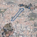
The majority of large European cities enjoy centuries old history which reveals itself through their landscapes comprising a number of architectural layers. Such a landscape should be protected and any new investment should be planned with particular attention that does not interfere into its integrity. This applies especially to tall buildings which visual impact can be significant. Therefore, provisions of the planning law should protect valuable urban structures and skyline against unorganised development of tall buildings (fig.1). Analytical 3D techniques using virtual city models can help establishing relevant laws. The article presents analytical techniques used in practice while examining landscapes of two Polish cities and describes theory discussed in a PhD dissertation. These are now under development within the 2TaLL research project funded from Norway Grants. The article presents two methods that are helpful while determining protection zones for the city skyline background: methods of view angle analysis and view range analysis (fig. 2). The method of dynamic view angle analysis provides for automatic development of angle maps for selected locations of panoramic exposition. The method of view range analysis enables visualising spatial spread of a panorama in a digital model of a city. The combining of results achieved through the application of the two methods enables determining which elements of a new planned development can be seen from a selected point in the city. The analyses have been successfully used in the planning process as a basis for defining guidelines for erecting new tall buildings and protecting old city skylines.
Rubinowicz P.: Exploring the Complexity. Digital Turn Towards Geometry in Contemporary Architecture and Urban Planning. In Hans-Peter Schröcker and Manfred Husty, editors, Proceedings of the 16th International Conference on Geometry and Graphics, pages 393–404. Innsbruck University Press, 2014. ISBN 978-3-902936-46-2.
Abstract
Many contemporary architectural designs show the trend of shift from classic understanding of the rational order of forms towards larger complexity. Clear examples of that include projects within the deconstruction trend of 80s and 90s of the past century. Nowadays, this phenomenon has a much broader scope and structure. The same refers to other trends in architecture, such as metabolism, folding, blob architecture, parametric modeling, and others. Catalyzers for those activities are digital techniques facilitating design and prefabrication processes. The use of repeatable elements in building ceases to be dictated by economic factors. 3D printing techniques and CNC provide less expensive production of structures having unique shapes.
The progress in IT technologies influences both physical development of built-up space as well as aesthetic perception and interpretation of beauty and harmony – separately from historically shaped cannons. The importance of “pure geometry” for contemporary architectural creation and urban analysis has been growing. The shape of many building facilities is defined through a computer-aided process, as well as geometrical sequences of transformations and their rules. The article analyzes complexity in architecture while presenting an individual typology within four patterns – methods describing the development of forms possible to be defined geometrically: decomposition, deformation, dispersion and new complexity (or beginning of higher order). The method of decomposition involves dividing, isolating the elements of form and their collision (e.g. trend of deconstruction, Parc de la Villette in Paris, architect B. Tschumi). Deformation method (Fig. 73) is to plasticizing structure while maintaining its integrity (e.g. folding, Möbius House, architect B. van Berkel). Dispersion lies in the use of a random factor in shaping forms: moving, rotating, changing proportions, color, etc. (e.g. Torre Agbar in Barcelona, architect J. Nouvel). The last method (new complexity) is related to the mathematical theory of deterministic chaos and fractal geometry indicating that simple rule, principle or law can provide a precise definition of highly complex, dense and irregular structure. Getting complex forms in architecture can be achieved using a simple modelling process (e.g. Federation Square in Melbourne – Fig. 74). The analyzes of presented methods are supported with computer simulations with use of own software.
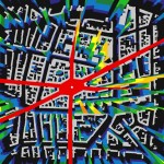
Architectural design aims at developing new forms, whereas urban planning is based to a higher degree on analyzing already existing cities which by their nature are more complex spatial structures. In urban planning, complexity is a starting point for further designing activities. Virtual 3D models of cities comprise an ideal tool. However, interpretation of the models requires relevant geometrical methods (Fig. 3). The article presents selected methods for analyzing cities with the use of 3D models while looking for references to the system of four patterns: decomposition, deformation, dispersion and, in particular, new complexity. Both in architecture and in urban planning we have a strong need to develop a geometrical language for describing, understanding and better shaping of the built-up environment. The article continues the idea expressed in the paper on “Chaos and Geometric Order in Architecture and Design”, (JGG vol. 4, 2000) and a PhD dissertation by the author. Paper is financed by Norway Grants (Project 2TaLL).
Zwoliński A.: Complexity of Public Spaces System Between Key Tall Buildings in City of Szczecin. Geometrical Aspect of Public Spaces in 3D City Model. In Hans-Peter Schröcker and Manfred Husty, editors,Proceedings of the 16th International Conference on Geometry and Graphics, pages 175–186. Innsbruck University Press, 2014. ISBN 978-3-902936-46-2.
Abstract
The concept of conference paper is strongly established on compilation of urban analyses of public spaces with environment of 3D city models. It is based on the understanding, that urban space in a composition of “positive” and “negative” – physical built-up environment and non-permanent dynamic pattern of users and their activities (see: Fig. 38). Presently, it is more and more proved, that public spaces are the driving force and determinants of urban quality in most cities. The most important public spaces of cities are commonly located within city center areas, however very often overlapping with locations of tall buildings. These are either tall historical buildings of cathedrals, churches, towers, palaces etc., or modern skyscrapers. The tall buildings are not the case itself for this article, but they are used only as a pretext for choice of case study areas directly located at such city “markers”.
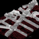
The 400.000 inhabitants city of Szczecin in north-west part of Poland has both of the mentioned “markers” in the city center. There is a number of churches with historical dominant of cathedral and also two main modern tall buildings located within the city center. Szczecin has good examples of key tall buildings located nearby or within important public spaces (squares, streets, boulevards etc.). The Fig. 39 (left) shows key locations of tall buildings (red) and general system of public spaces (blue gradient). Recent period of rapid development in computer technologies affects also sphere of architecture and urban design. Technology of 3D city models are being intensively developed 56 for different uses and also it seems to be very perspective and attractive for application in terms of advanced urban analyses. It inspires a multi-purpose approach to analysis of cityscape using 3D models, particularly a “negative” part – called 3D void between buildings. The paper uses concept of representation of public spaces in 3D city model as 3D multiface bodies with measurable different level of complexity. This gives an opportunity of converting typical 2D urban analyses into the world of advanced spatial geometry including more parameters describing 3D solids (see: Fig. 39 – right).
The attempt of parameterization of public spaces using concept of 3D solids representing space between buildings will be a subject of this paper. The 3D city model will be used 57 to generate 3D geometry of public spaces around tall buildings in the selected area. The detection will be processed using cut surfaces multiplied through selected 3D void along XYZ axes of 3D model. The final geometry will be detected by Boolean operations and subtraction of shapes in sectional views (Fig. 40). The geometry will be used to read and interpret such parameters like, for example, geometrical complexity of urban space, total volume, functional pattern, capacity for users etc. The general outcome will be multi-aspect observation of part of Szczecin’s cityscape in terms of geometry of key public spaces in city center area where the tall buildings are located.
Czyńska K.: Zabudowa wysoka i krajobraz Mediolanu. Tall buildings and the cityscape of Milano, Przestrzeń i Forma 2014, nr 22/1, pages 107-122, Wydawnictwo Uczelniane ZUT, Szczecin 2014. e-ISSN 2391-7725, ISSN 1895-3247.
Abstrakt
Zabudowa wysoka stała się w ostatnich latach istotnym składnikiem krajobrazów wielu miast europejskich. Tendencja ta zatacza coraz szersze kręgi i pojawia się w dotychczas nisko zabudowywanych, historycznych miastach. Jednym z nich jest Mediolan, w którym w ostatnich latach stale wzrasta ilość nowych obiektów wysokościowych. W artykule omawiana jest specyfika przestrzenna miasta, w kontekście rozpoznania znaczenia zabudowy wysokiej dla kształtowaniu jego współczesnego wizerunku. Do analizy struktury urbanistycznej zastosowano elementy komputerowej metody wyznaczania zasięgu oddziaływania wizualnego budynku, w celu identyfikacji miejsc i obszarów ekspozycji. Wyniki symulacji zostały zweryfikowane przez Autorkę podczas badań przeprowadzonych w Mediolanie w 2013 roku.
Czyńska K.: Atrakcyjność krajobrazu miejskiego a zabudowa wysoka – na przykładzie wybranych miast europejskich. Attractiveness of urban landscape versus tall buildings – on the example of selected European cities, Przestrzeń i Forma 2015, nr 24, pages 131-144, Wydawnictwo Uczelniane ZUT, Szczecin 2014. e-ISSN 2391-7725, ISSN 1895-3247.
Abstrakt
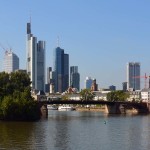
Zabudowa wysoka stała się w ostatnich dekadach bardzo aktualnym problemem dla wielu prężnie rozwijających się miast europejskich. Z uwagi na wielowiekową historię, powinno się dążyć do zachowania i harmonijnego rozwijania ich krajobrazów. W celu uniknięcia negatywnych interakcji z cennymi założeniami urbanistycznymi i architektonicznymi, lokalizacja nowych obiektów wysokich w sylwecie miasta powinna być poprzedzona obiektywnymi badaniami ich przyszłego oddziaływania w krajobrazie miasta. Niniejszy artykuł prezentuje wnioski z wybranych badań przeprowadzonych w ramach projektu: „Application of 3D Virtual City Models in Urban Analyses of Tall Buildings”. Przedmiotem prezentowanych analiz jest systematyka porównawcza wpływu zabudowy wysokiej na krajobraz, przeprowadzona na przykładzie Wiednia, Kolonii i Frankfurtu.
Czyńska, K.: Application of Lidar Data and 3D-City Models in Visual Impact Simulations of Tall Buildings, Int. Arch. Photogramm. Remote Sens. Spatial Inf. Sci., XL-7/W3, 1359-1366, doi:10.5194/isprsarchives-XL-7-W3-1359-2015, 2015.
Abstract
The paper examines possibilities and limitations of application of Lidar data and digital 3D-city models to provide specialist urban analyses of tall buildings. The location and height of tall buildings is a subject of discussions, conflicts and controversies in many cities. The most important aspect is the visual influence of tall buildings to the city landscape, significant panoramas and other strategic city views. It is an actual issue in contemporary town planning worldwide. Over 50% of high-rise buildings on Earth were built in last 15 years. Tall buildings may be a threat especially for historically developed cities – typical for Europe. Contemporary Earth observation, more and more available Lidar scanning and 3D city models are a new tool for more accurate urban analysis of the tall buildings impact. The article presents appropriate simulation techniques, general assumption of geometric and computational algorithms – available methodologies and individual methods develop by author. The goal is to develop the geometric computation methods for GIS representation of the visual impact of a selected tall building to the structure of large city. In reference to this, the article introduce a Visual Impact Size method (VIS). Presented analyses were developed by application of airborne Lidar / DSM model and more processed models (like CityGML), containing the geometry and it’s semantics. Included simulations were carried out on an example of the agglomeration of Berlin.
Rubinowicz, P. and Czyńska, K.: Study of City Landscape Heritage Using Lidar Data and 3d-City Models, Int. Arch. Photogramm. Remote Sens. Spatial Inf. Sci., XL-7/W3, 1395-1402, doi:10.5194/isprsarchives-XL-7-W3-1395-2015, 2015.
ABSTRACT
In contemporary town planning protection of urban landscape is a significant issue. It regards especially those cities, where urban structures are the result of ages of evolution and layering of historical development process. Specific panoramas and other strategic views with historic city dominants can be an important part of the cultural heritage and genius loci. Other hand, protection of such expositions introduces limitations for future based city development. Digital Earth observation techniques creates new possibilities for more accurate urban studies, monitoring of urbanization processes and measuring of city landscape parameters. The paper examines possibilities of application of Lidar data and digital 3D-city models for: a) evaluation of strategic city views, b) mapping landscape absorption limits, and c) determination protection zones, where the urbanization and buildings height should be limited. In reference to this goal, the paper introduces a method of computational analysis of the city landscape called Visual Protection Surface (VPS). The method allows to emulate a virtual surface above the city including protection of a selected strategic views. The surface defines maximum height of buildings in such a way, that no new facility can be seen in any of selected views. The research includes also analyses of the quality of simulations according the form and precision of the input data: airborne Lidar / DSM model and more advanced 3D-city models (incl. semantic of the geometry, like in CityGML format). The outcome can be a support for professional planning of tall building development. Application of VPS method have been prepared by a computer program developed by the authors (C++). Simulations were carried out on an example of the city of Dresden.
Zwolinski, A. and Jarzemski, M.: Computing and monitoring potential of public spaces by shading analysis using 3d lidar data and advanced image analysis, Int. Photogramm. Remote Sens. Spatial Inf. Sci., XL-7/W3, 743-750, doi:10.5194/isprsarchives-XL-7-W3-743-2015, 2015.
ABSTRACT
The paper regards specific context of public spaces in “shadow” of tall buildings located in European cities. Majority of tall buildings in European cities were built in last 15 years. Tall buildings appear mainly in city centres, directly at important public spaces being viable environment for inhabitants with variety of public functions (open spaces, green areas, recreation places, shops, services etc.). All these amenities and services are under direct impact of extensive shading coming from the tall buildings. The paper focuses on analyses and representation of impact of shading from tall buildings on various public spaces in cities using 3D city models. Computer environment of 3D city models in cityGML standard uses 3D LiDAR data as one of data types for definition of 3D cities. The structure of cityGML allows analytic applications using existing computer tools, as well as developing new techniques to estimate extent of shading coming from high-risers, affecting life in public spaces. These measurable shading parameters in specific time are crucial for proper functioning, viability and attractiveness of public spaces – finally it is extremely important for location of tall buildings at main public spaces in cities. The paper explores impact of shading from tall buildings in different spatial contexts on the background of using cityGML models based on core LIDAR data to support controlled urban development in sense of viable public spaces. The article is prepared within research project 2TaLL: Application of 3D Virtual City Models in Urban Analyses of Tall Buildings, realized as a part of Polish-Norway Grants.
Czyńska K. Rubinowicz P.: Visual protection surface method: Cityscape values in context of tall buildings, K. Karimi, L. Vaughan, K. Sailer, G. Palaiologou, T. Bolton (eds), Proceedings of the 10th International Space Syntax Symposium, pages: 142:1-142:10, London 2015.
ABSTRACT
The paper introduces a method of computational analysis of the city landscape called Visual Protection Surface (VPS). The method allows to explore geometrical relations between the scope of visual protection of the city and the maximum heights of new buildings. In contemporary town planning protection of urban landscape is a significant issue, especially for historically composed cities in Europe. Specific panoramic views exposing significant landmarks can be an important element of cultural heritage. On the other hand there are aspirations to modernize the image of a city and highlighting its economic potential. The trend to build tall buildings in Europe is growing and the majority of such facilities were built this century. Strategies for developing a city usually take into consideration the need to protect the historical landscape. Main assumptions of many strategies includes selection of so called strategic views foreseen for complete or partial protection (e.g. in London 27 views, in Koln 9 views). The question is: how the city can develop without losing existing valuable views? How to create its contemporary identity in accordance with tradition? How the actual computational techniques can support planning? The Visual Protection Surface (VPS) method uses the virtual city models as basis for calculations. Input data include: coordinates for a number of strategic views and a 3D city model. Results achieved: the surface above the city defines the maximum height of buildings in such a way that no new facility can be seen in any of the strategic views. On the one hand the VPS-method can be used for verification of the potential location of tall building in the city. On the other it can be a verification tool of actual protection strategies, which could be too restrictive. The paper presents the background of VPS, the methodology and sample application: using the computer program developed by authors (dedicated for CityGML data processing) and using other GIS software.
Czyńska, K., Rubinowicz, P. and Zwolinski, A, 2TaLL: Application of 3D Virtual City Models in Urban Analyses of Tall Buildings, eds. PPH Zapol, ISBN 978-83-7518-768-7, Szczecin 2016
Słowo wstępne o metodach analiz przestrzennych, opracowanych w projekcie 2TaLL
Rezultatem projektu 2TaLL jest szereg nowych metod analitycznych umożliwiających badania wpływu nowej zabudowy wysokiej na miasto. W szczególności badania widoczności w oparciu o metodę Visual Protection Surface (VPS) wprowadzają nowe możliwości dla praktyki urbanistycznej, opartej o poszanowanie historycznej tkanki miast. Złożony proces ochrony panoram w miastach historycznych zyskuje wiele nowych możliwości przy zastosowaniu tego typu analiz. Poza zagadnieniami widoczności, autorzy badają również jakość przestrzeni publicznych w otoczeniu zabudowy wysokiej, także w kontekście zacieniania. Obserwowany trend postępującej urbanizacji i wzrastająca potrzeba wznoszenia struktur urbanistycznych wysokiej gęstości będzie wpływała niezwykle silnie na rozwój urbanistyczny Europy w nadchodzących latach. Uzasadnia to potrzebę stosowania nowoczesnych, cyfrowych narzędzi analitycznych podobnych do tych, które narodziły się w ramach projektu 2TaLL.
Wprowadzenie trzeciego wymiaru przestrzeni oraz jego integracja z analizami widoczności obszarów miejskich umożliwia nowatorską systematykę analiz widokowych. Najważniejsza jest kompleksowa analiza zasięgu widokowego budynku nie tylko w bezpośrednim, ale także dalekim kontekście. Ogromną przewagą jest możliwość analizy wszystkich możliwych lokalizacji w strukturze urbanistycznej – zamiast ograniczenia tylko do jednej, wskazanej pozycji. Właśnie z tego powodu analiza może być uznana za kompleksową. Badania wielu miast europejskich przeprowadzonych w projekcie 2TaLL: Drezno, Bruksela, Monachium, Berlin, Frankfurt, Rotterdam, Delft i innych, pokazują, że zaawansowane modele 3D (uwzględniające cechy semantyczne) mogą być stosowane w sposób analityczny. W nadchodzących latach tego rodzaju modele powstaną dla większości miast na świecie. Architektoniczny zespół badawczy projektu 2TaLL opanował technologicznie nie tylko umiejętności komputerowej aplikacji metody VPS, ale również pokonał wyzwania dotyczące operowania na zupełnie różnych typach danych: CityGML, LiDAR. Prezentowane przykłady badań struktur miejskich, opracowane przez autorów projektu 2TaLL są wizualnie imponujące. lustrują zarówno ogromny potencjał analityczny stosowanych metod jak też ich wysoki potencjał praktyczny, umożliwiający aplikację w realnym planowaniu. Pozostaje tylko mieć nadzieję, że zespół badawczy będzie kontynuował i rozwijał badania w tej dziedzinie.
Reinhard Koenig, Junior-Professor Dr.
Bauhaus Universität Weimar, Technische Universität München, ETH Zurich
Czyńska, K. and Rubinowicz, P.: Visual Impact Size method in planning tall buildings, Monograph of ASK.the.conference, Warsaw 2016 [in printing]
Zwoliński, A. and Rubinowicz, P. Geometries of cityscape. Analysis and detection of public spaces beneath tall buildings by 3D-Negatives. Monograph of ASK.the.conference, Warsaw 2016 [in printing]
 Pełny tekst w PDF
  Pełny tekst w PDF
  Pełny tekst w PDF
 Pełny tekst w PDF
 Pełny tekst w PDF
 Pełny tekst w PDF
 Pełny tekst w PDF
 Pełny tekst w PDF
 Pełny tekst w PDF
 Pełny tekst w PDF
 Pełny tekst w PDF
 Pełny tekst w PDF